MSME
Welcome to AAL Surveying & Aeronautical Mapping
Your Trusted Partner in Aeronautical Survey Excellence
Delivering compliant, reliable, and DGCA-standard aeronautical data
About Us


Precision Mapping Backed by Expertise.
For over three years, our distinguished land surveying agency has been a frontrunner in the industry—expertly mapping surface features and utilities, executing high-precision airport surveys, and delivering meticulous data post-processing. With extensive project experience across India, we have established ourselves as a trusted leader in comprehensive land surveys, water aerodrome surveys, and helipad/heliport surveying services.
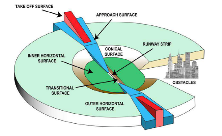
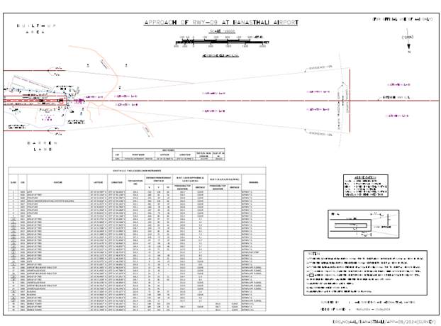
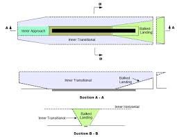
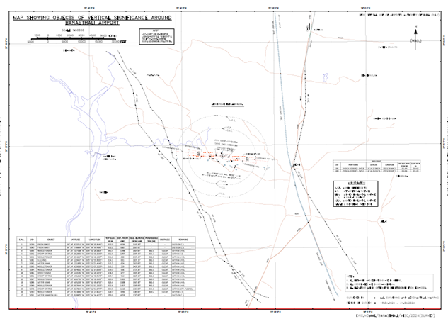
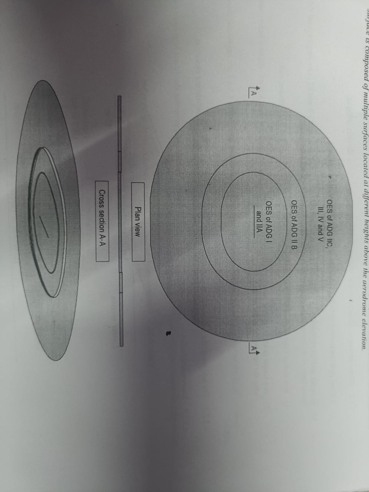
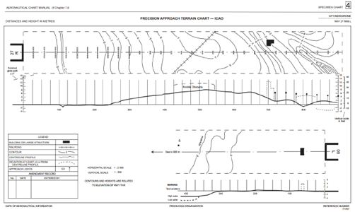
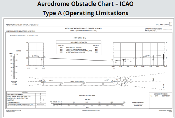
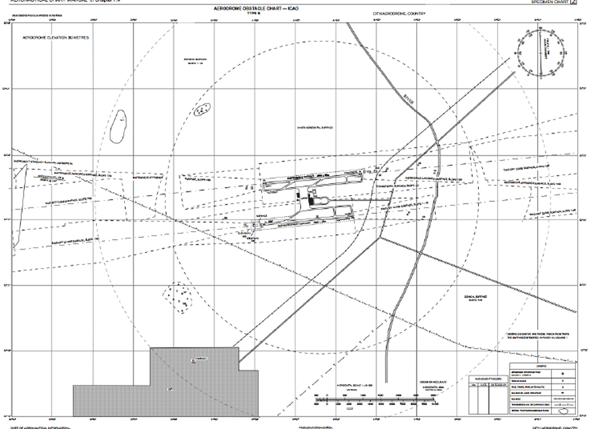
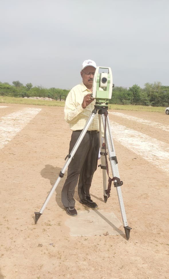
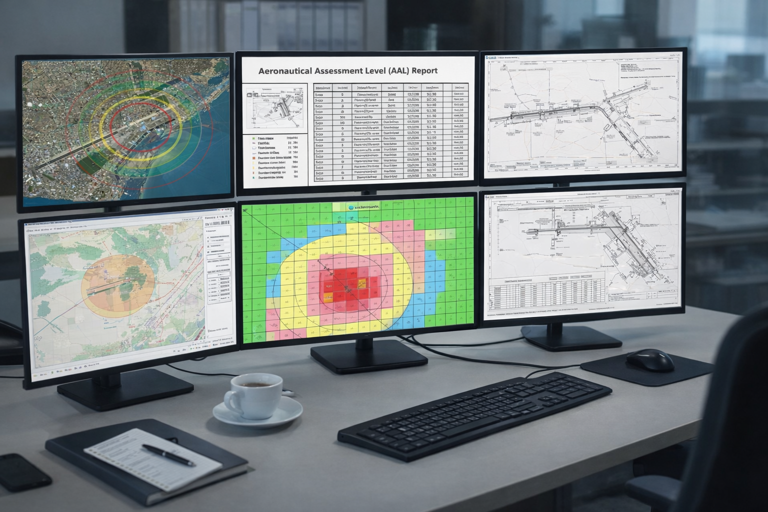
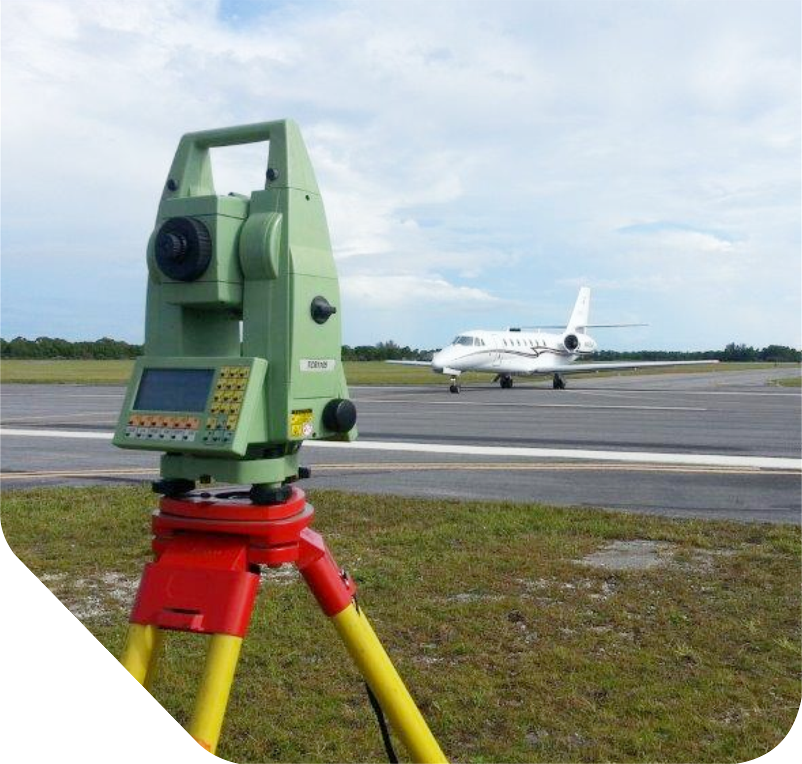
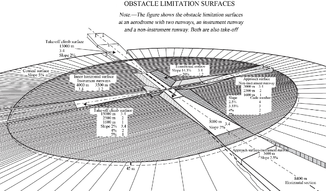
Obstacle Limitation Survey
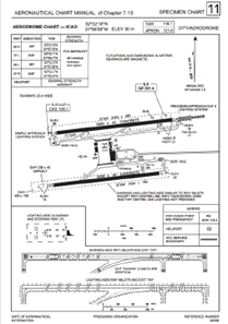
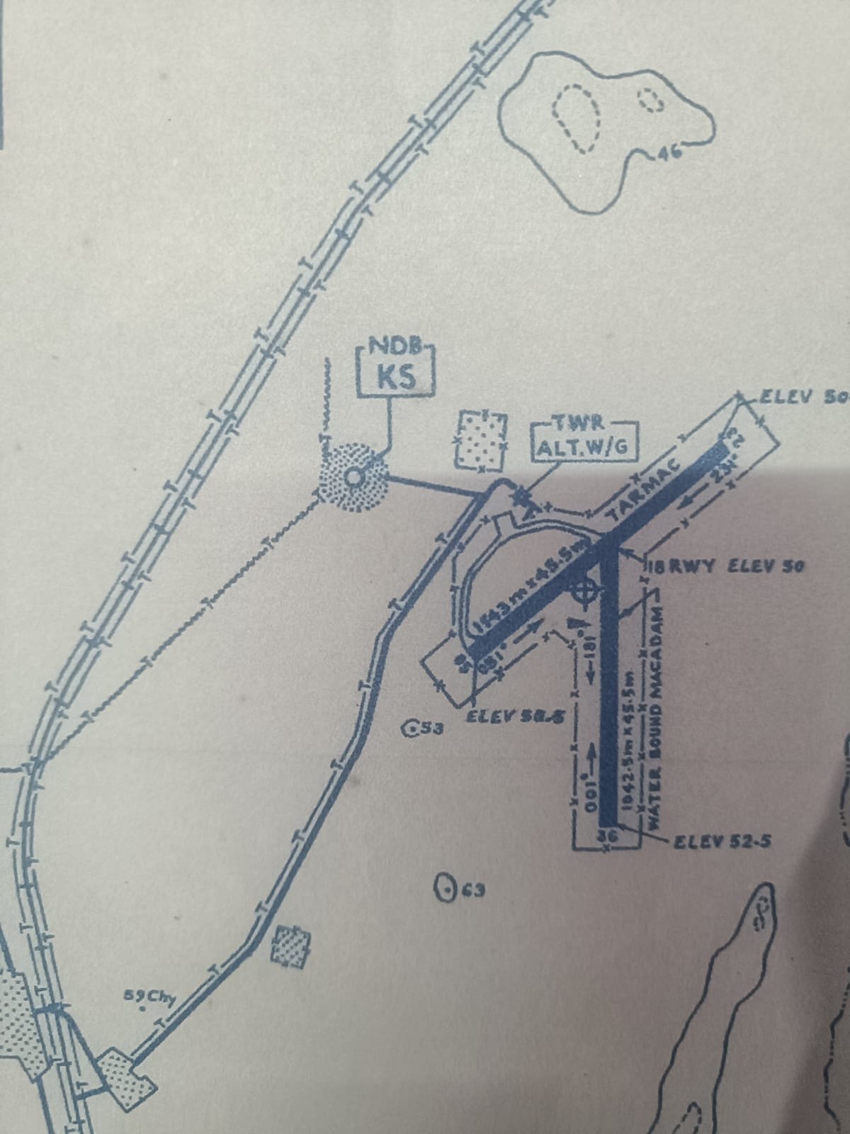
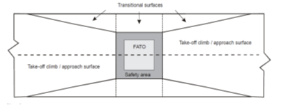
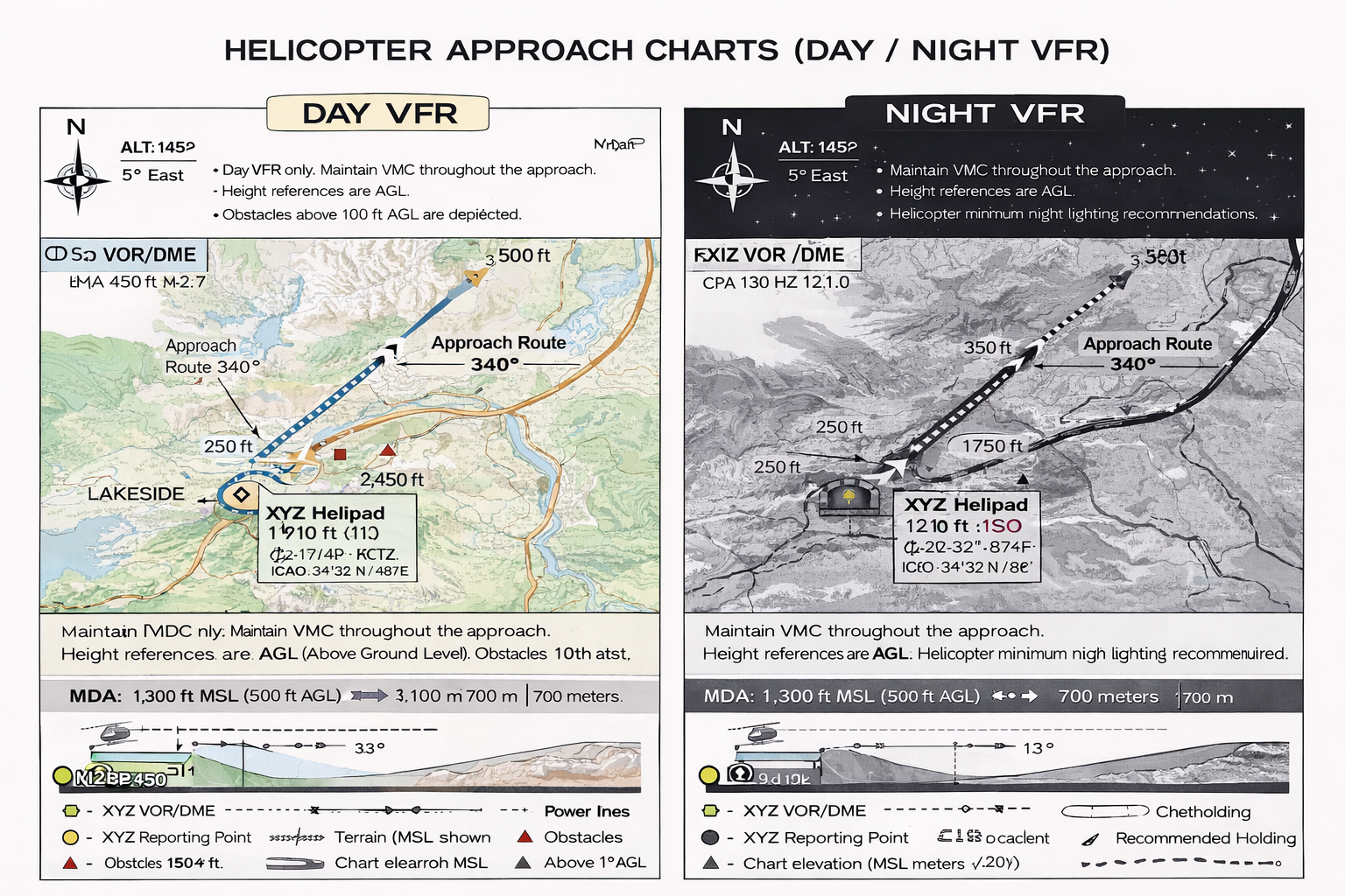
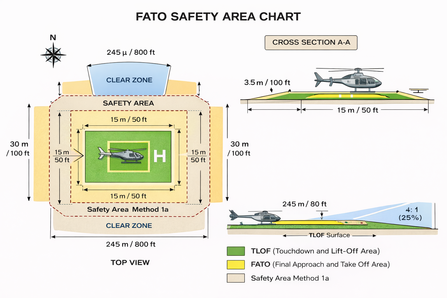
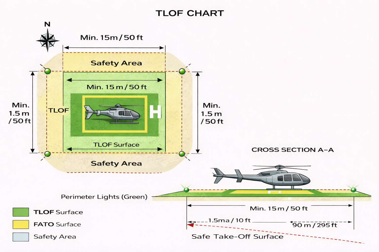
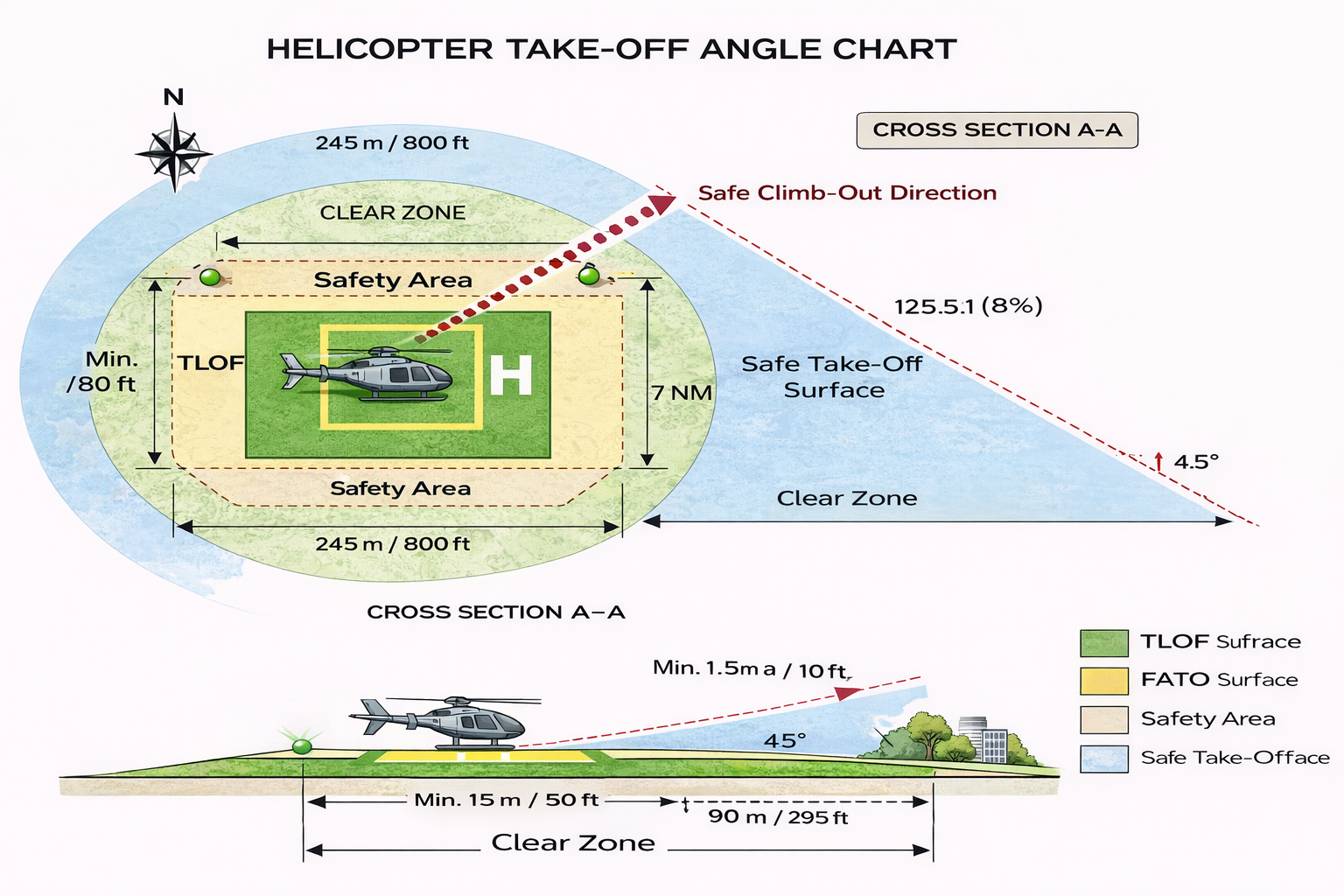
Heliport Charts
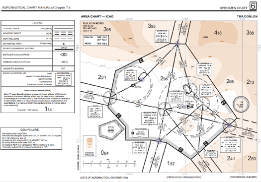
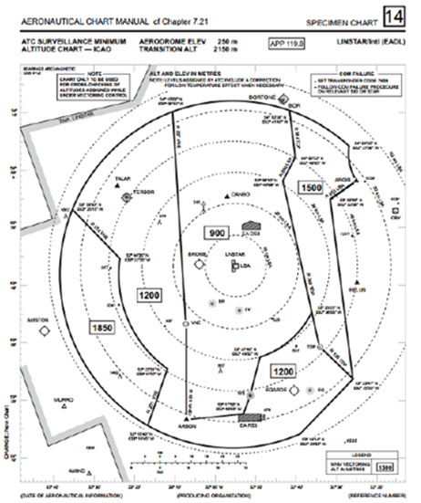
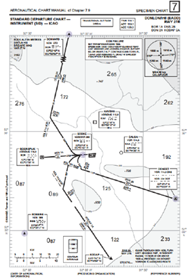
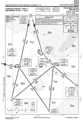
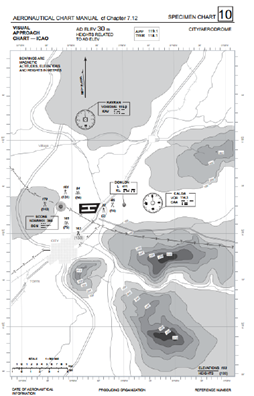
Air Route Charts
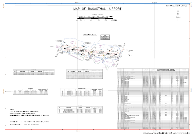
Aeronautical Survey
Services